
Mt. Willey, Mt. Fields, and Mt. Tom
Welcome to episode 3 of the Michael and Chris hiking adventure, featuring Mt. Willey, Mt. Fields, and Mt. Tom! This week’s episode features 3 special peaks, one long trail, and a pine marten named Charlie.
The start of this daunting voyage begins with Chris and I preplanning this epic trip with one giant loop and then having a possible ride back to our cars by the very gracious Rain. The trip would begin heading up to Mt. Willey, enjoy the views and eat some food, then make our way up and over to Mt. Fields, where we will enjoy more views and food, continuing the climb to Mt. Tom where we will stay for a short time and begin the long haul back to our (now very distant) car. Sounds fun eh?
Start 10:03am
The hike up to the peak of Willey, presented to be a real workout on our cardiovascular system. I’m not saying we are out of shape, just saying it’s a good work out (seriously). What made this trek more vigorous in comparison to the last was the ratio between distance and elevation gain. In other words, the hike was really steep at long portions of the trail — even with the switchbacks.
Ripley Falls 10:29am
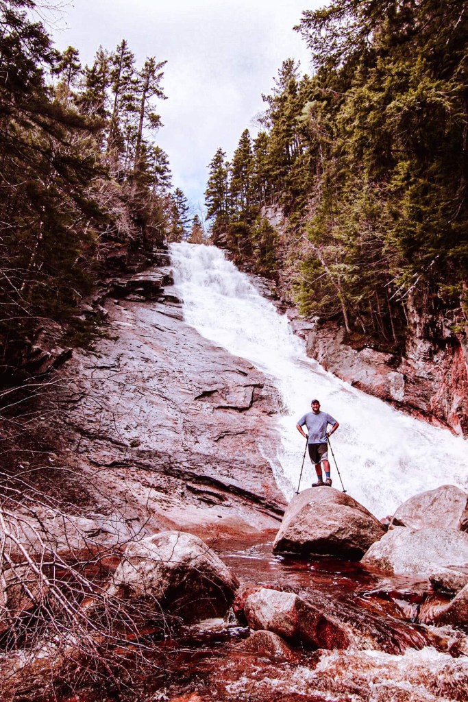
The first portion of the trail we decided to take a minor detour to see the Ripley Falls Waterfall. To my own surprise, this waterfall was much larger and active than I originally thought. I assumed it was going be a slower moving waterfall. For those doing this trek, I would encourage you to take this detour. It’s not far off course and took us only around 30 min to get there and probably 10 to get back onto the Willey Range Trail. We ended up spending about 15 minutes there and it was worth the view.
Willey Range Trail 12:02pm
The Willey Range Trail was our only trail straight to the top where we would be able to see out over the valley.
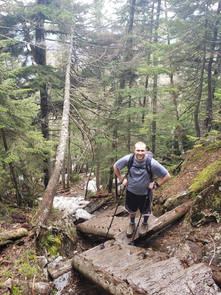
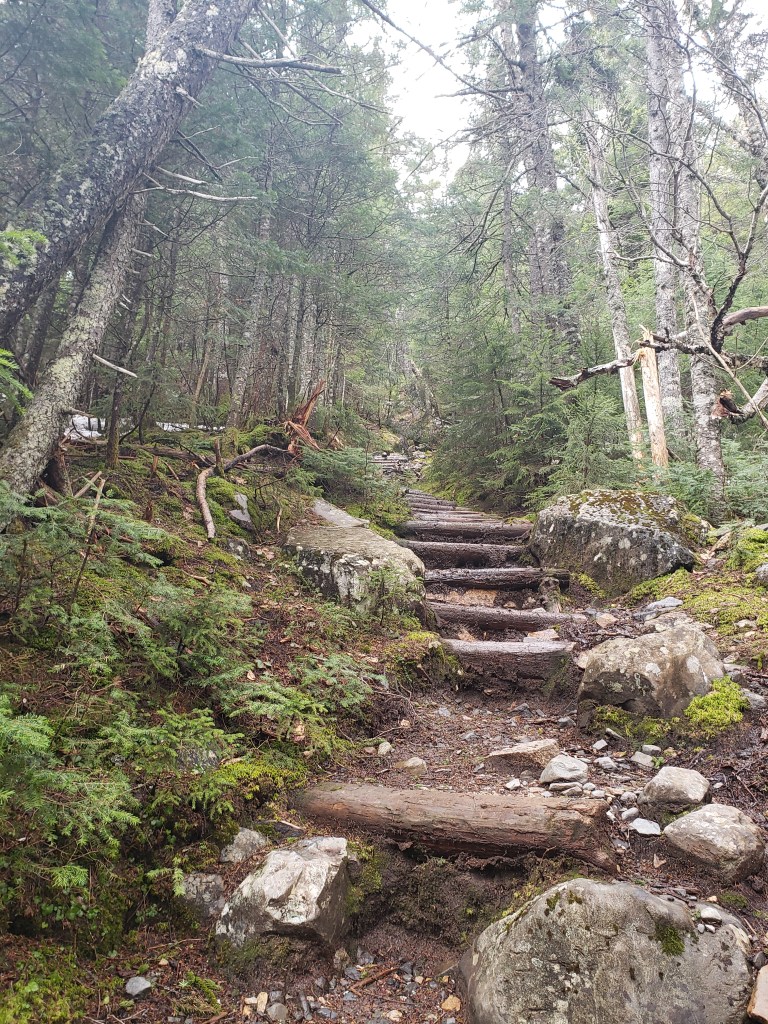
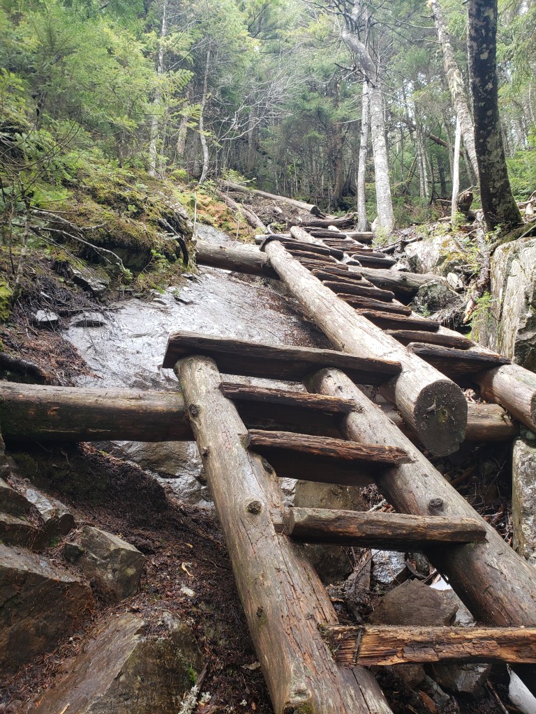
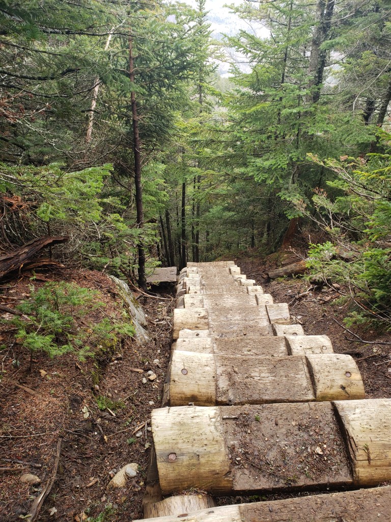
We trekked through several streams that trickle through the trail, over washed out rocks and mud, and under a few large branches and trees that fell over. We were definitely being put to the test today. Every now and then we came across a portion where leveled steps were created ( I’d assume to help push water off the trail and keep the rocks from washing out the trail.
After about an hour we were presented a steeper climb, with the aide of some stairs that were implemented. Regardless of the stairs though, it was super steep and required more energy than I was hoping to give.

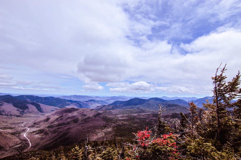
Once we finally made it to the top, we decided it was a well deserved lunch break. The top of Willey has only one look out, but it doesn’t disappoint. In addition to the beautiful views of the surrounding peaks and valleys, the local birds like to be a bit more friendly than anywhere else. Simply by holding out your hand, they are more than happy to take whatever you feed them. Just remember to feed them things that are reasonable and safe. I brought homemade trail mix, so I broke down a bunch of granola.


Journey Over The Ridge
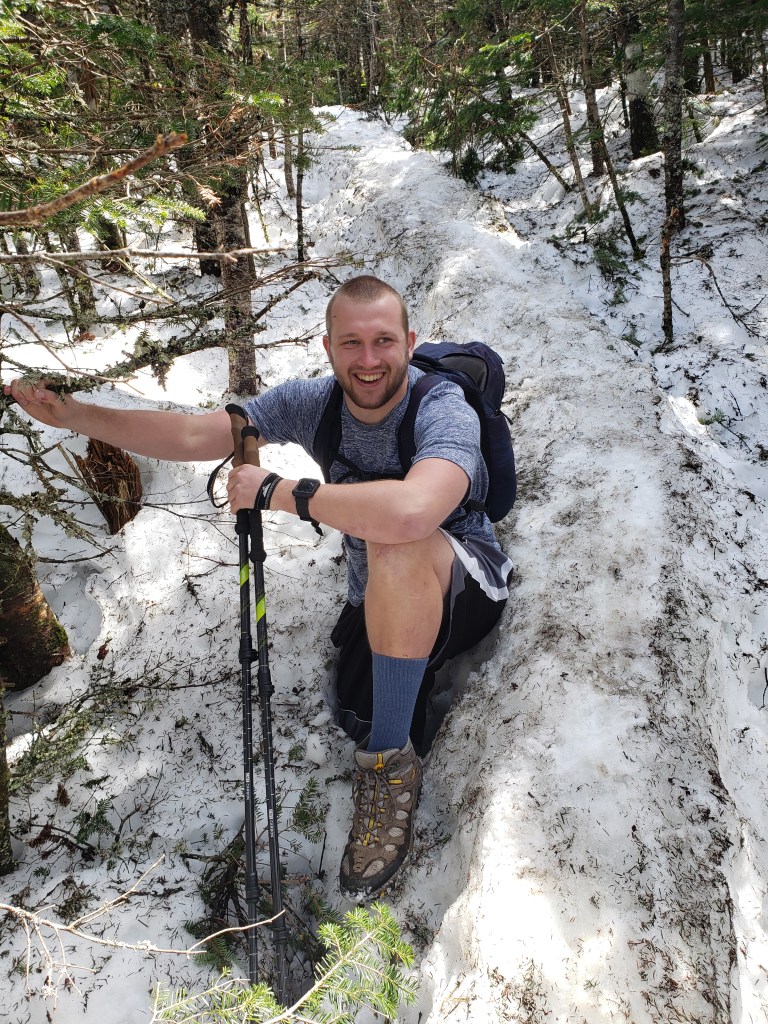
The journey across the ridge was a pretty straight shot all the way to Mt. Fields. It’s always nice to have a trail that stays on the ridge line, because the elevation change is minimal. If it wasn’t for the stupid snow, I’m sure our time across would have been much better. We trekked as fast and as steady as we could. I would like to have said the journey across was a piece of cake… That wasn’t the case.

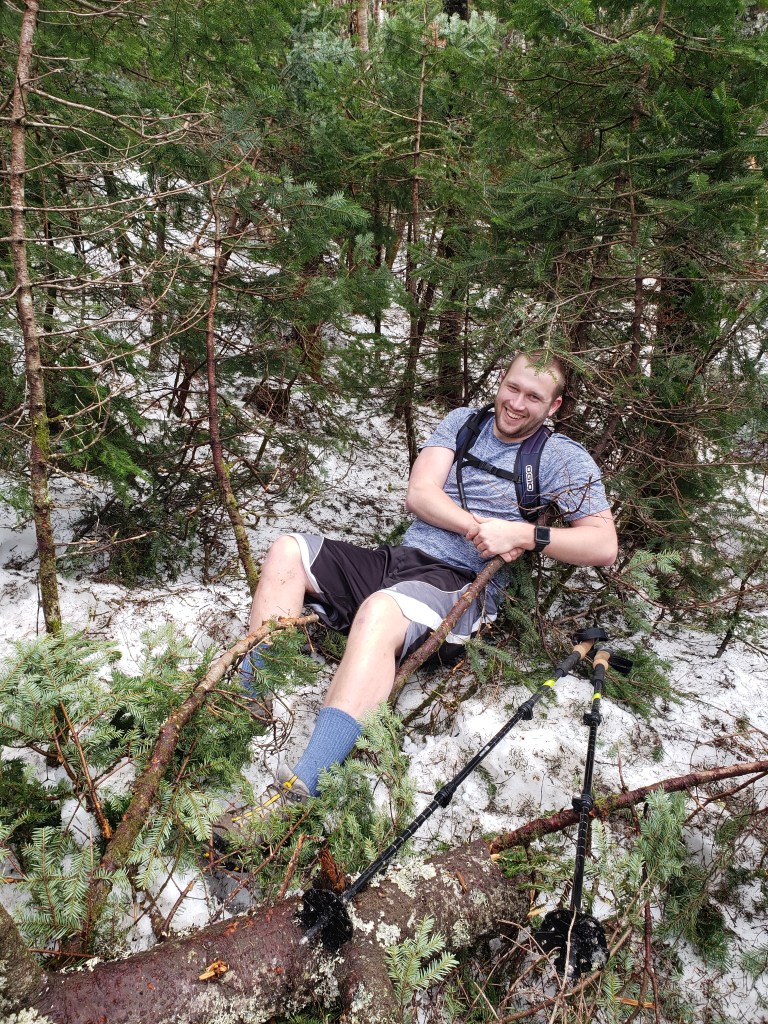
Our trek began with some descending and working our way down the peak of Willey. Not too hard, but the monorail made it slippery. Make sure you continue to check the weather conditions before hiking and plan on bringing appropriate gear. Much of the ascent to Willey was perfectly fine without any traction gear, however going across the ridge line, the monorail was rather slippery and lots of post-holing was accomplished. Just ask Chris, he loves post-holing!
Those who are new, post-holing is when you fall through the melting snow that is packed down on the trail. Not fun. Chris knows… Don’t worry I definitely took some pictures. You’re welcome. He’s a good sport.

Mt. Fields
Mt. Fields was our next target which came a lot quicker to us than we thought. A good portion of the trail had minimum elevation change, making the trek easier, however, the monorail was still no fun.
Mt. Fields is an “okay” peak, the views are great, but you a get a nice view of the side of Washington along with a straight shot view at the Mt. Washington Resort. Other than that, you are pretty limited in the views. We made due with our time there, taking another food break before our continuation.

Once again our journey continued and after some routine falling and momentarily stopping to help Chris out of such holes, we made it all the way to the A-Z trail. He wasn’t the only one who fell during the trek, I made a few nice foot holes as well, some as deep as 3-4 feet (waist deep)
A-Z Trail
The A-Z trail was only 80 yards from this point to where we would begin to summit Mt. Tom. Thankfully that meant we were almost done! Well not quite, but at least 3/4 of the way done! It was getting later in the day by this point and we still had one more peak to climb and then descent.
Mt. Tom
Hiking up the last portion of our trip was fairly easy, the elevation gain wasn’t much compared to the distance, meaning the trek was only a slight incline. Once we made it to the top, we celebrated that we were nearly done. The time was pushing 6 o’clock at this part and we knew we couldn’t spend too much time at the top. Unfortunately, the top didn’t have any great views because of the tree growth, but you could peak out over the top in some spots.
Now, I’ve only had a few moments in New England where I have witnessed an animal that I have never seen before. Today was one of those times. As Chris and I made it back to the A-Z trail, we were checking in on our log, and I noticed something running behind Chris. Looking panicked, I couldn’t get the words out of my mouth, except for “Chris, be-behind you!”. Which of course any other sane person would be thinking something along the lines of a bear, this was not the case. With a quick but careful spin Chris turned to see what I could not describe. What was it exactly? Well at the moment of first sight my only description was the combination of a fox, cat, dog, and weasel. Yeah not very descriptive. About the size of small dog, cat like features, fox color and tail, and weasel because I knew it wasn’t any of the previous animals I described. Here is a picture, and I’ll let you decide before I tell you.
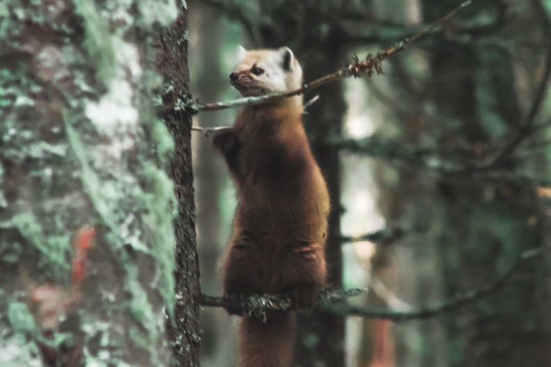
What is this cute fluffy creature? It’s a Pine Marten. Which I have never heard of before this lovely encounter. Normally I feel these animals would be cautious of travelers and stay far away. Not this little guy. He hopped around and circled Chris and I for at least 20 minutes, getting closer and closer and then running back. At one point I think he had to have been at least 3 meters from me! I was overjoyed and wanted to keep him (naturally) I named him Charlie, seemed to fit his character.
Sadly we had to move on and let him be. We, ourselves, scurried on down the trail that would eventually bring us out to the Highland Center. So, if you’re curious at what time it is currently for us at this point, you guessed it 7:15. It was going to get dark quickly…. Oh and the Highland Center wasn’t where we parked our cars. We parked another 4 miles down the road from there.
Yeah we knew what we were getting ourselves into, we just assumed we could get it done quicker than what the guide book said. In normal summer conditions I believe we could have done it much quicker.
The Highland center was just under 2 miles from the trail junction to the Peak of Mt. Tom. Plus it was a descent so the time going down should be much quicker than the time going up. As we trekked down the trail we had to cross a river with a decent current. The current wasn’t the problem though, the lack of rocks to stand on was the problem. There was a large gap between the nearest dry spots from each side. Either we had to chance it and jump or find a new way. But why settle for only 2 options, why not take 25 minutes and try making a bridge? That sounds like a public service. So that is exactly what we did, taking rocks from the area and trying to pile them up across the river so we could skip across.
Let’s just say that plan didn’t work and our efforts fell short with the lack of materials for “said project”. We ran out of rocks… and the rocks we did use didn’t make it over the water level…
But we did make it across the river about 20 yards upstream! The last half mile was really quick and we got back down to the Highland Center parking lot before the sun set. Success!! Next was the 4 mile walk to our car along the side of the road. Yeah it was as much fun as it sounds.
The four miles down the road was completely in the dark, but don’t worry we were prepared for our adventure and brought flashlights.
I could talk about the 4 mile long journey, however its pretty boring. The only exciting thing we did see however was a super bright sky with the moon and cloudless sky showing the stars. So that was pretty awesome.
It was a long journey but a good one!
Don’t forget to check out the Te/So bag! Now that I’ve had it for a while I really enjoy the product. I will be working on a full review with some videos on the bag, too. Stay tuned and don’t forget to use our code “training4tomorrow” so you can get 15% off any purchase!


Loved this narrative – interesting and entertaining! Chris needs to get some pictures of you post-holing! Sounds scary being so deep!
How many peaks have you done so far? ❤️
LikeLike
Sounds like a great adventure…love the critter! Very enjoyable read!
LikeLiked by 1 person